![](/images/other/stat-length.png)
![Tour Wandern Florac Trois Rivières - Le Sentier des Couronnes - Florac - Photo](https://media.geolcdn.com/t/1900/400/ext.pjpeg?maxdim=2&url=https%3A%2F%2Fservices.sitytrail.com%2FGeolivesWS%2FDownloadMedia.ashx%3FTrailID%3D129855%26Media%3D13413_6.jpg)
Le Sentier des Couronnes - Florac
tracegps
Benutzer
![Länge](/images/other/stat-length.png)
![Maximale Höhe](https://static1.geolcdn.com/siteimages/upload/files/1508320355ic_sort_altitude_max_24dp.png)
![Positive Höhendifferenz](https://static1.geolcdn.com/siteimages/upload/files/1508320355ic_sort_den_pos_24dp.png)
![Km-Effort](/images/other/stat-length.png)
![Min. Höhe](https://static1.geolcdn.com/siteimages/upload/files/1508320355ic_sort_altitude_min_24dp.png)
![Negative Höhendifferenz](https://static1.geolcdn.com/siteimages/upload/files/1508320355ic_sort_den_neg_24dp.png)
![Boucle](https://static1.geolcdn.com/siteimages/upload/files/16400158638029165_repeat_loop_refresh_sync_direction_icon.png)
![Wandern](https://static1.geolcdn.com/sitytour/trail-icons/101.png)
5h00
Schwierigkeit : Schwierig
![Scannen Sie diesen QR-Code, um die Tour in der SityTrail-Anwendung zu öffnen](https://capi.geolives.com/qq0zvz2zws4bq2lad0pu/sitytour/trails/129855/qr.png?size=200)
Kostenlosegpshiking-Anwendung
Über SityTrail
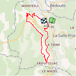
Tour Wandern von 15,3 km verfügbar auf Okzitanien, Lozère, Florac Trois Rivières. Diese Tour wird von tracegps vorgeschlagen.
Beschreibung
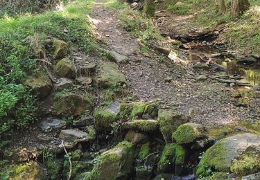
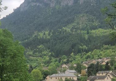
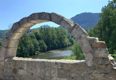
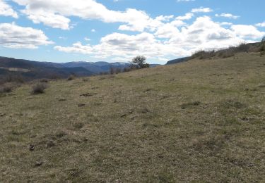
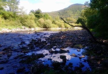
Randonnée entre causse et falaises avec une vue sur les Cévennes et plus si beau temps dégagé. Parking: sous le château (siège du Parc National des Cévennes) en centre ville vers la source du pécher. Sortir de Florac par le nord et gagner le lotissement des Grézes (sentier du Gralhon) puis le centre équestre de Gralhon. Remonter par des sentiers aux antennes sur le causse. Après la table d'orientation descendre sous la bordure du causse en suivant un bon sentier jusqu'au "rochefort" et sous les "jalses de Croupillac" emprunter le sentier qui descend vers Croupillac. Avant le hameau, partir au nord en suivant un balisage vert qui rejoint un chemin carrossable que l'on suit. Descendre dans l'épingle de la route et trouver la suite un peu plus loin sur la droite, une sente qui descend fort pour gagner la source du pécher et le parking.
Ort
Kommentare
Touren in der Umgebung
![Tour Wandern Bédouès-Cocurès - Stevenson Bedouès Barre des Cévennes - Photo](https://media.geolcdn.com/t/375/260/86b0857f-5630-4b37-8494-7a00373be256.jpg&format=jpg&maxdim=2)
![Wandern Wandern](https://static1.geolcdn.com/sitytour/trail-icons/101.png)
Wandern
![](/images/other/stat-length.png)
![](https://static1.geolcdn.com/siteimages/upload/files/16400158638029165_repeat_loop_refresh_sync_direction_icon.png)
![Tour Zu Fuß Florac Trois Rivières - Florac - Photo](https://media.geolcdn.com/t/375/260/f2a77ee2-7a86-4802-91d2-226710ca6f1c.jpeg&format=jpg&maxdim=2)
![Zu Fuß Zu Fuß](https://static1.geolcdn.com/sitytour/trail-icons/100.png)
Zu Fuß
![](/images/other/stat-length.png)
![](https://static1.geolcdn.com/siteimages/upload/files/16400158638029165_repeat_loop_refresh_sync_direction_icon.png)
![Tour Wandern Florac Trois Rivières - Panoramique des couronnes - Photo](https://media.geolcdn.com/t/375/260/7019c90e-f046-4f38-8c65-fb0ab66f3f22.jpg&format=jpg&maxdim=2)
![Wandern Wandern](https://static1.geolcdn.com/sitytour/trail-icons/101.png)
Wandern
![](/images/other/stat-length.png)
![](https://static1.geolcdn.com/siteimages/upload/files/16400158638029165_repeat_loop_refresh_sync_direction_icon.png)
![Tour Wandern Florac Trois Rivières - Les Cévennes sentiers sympas - Photo](https://media.geolcdn.com/t/375/260/39fe67cd-54e7-4946-b242-3ad32b0a4775.jpg&format=jpg&maxdim=2)
![Wandern Wandern](https://static1.geolcdn.com/sitytour/trail-icons/101.png)
Wandern
![](/images/other/stat-length.png)
![](https://static1.geolcdn.com/siteimages/upload/files/16400158638029165_repeat_loop_refresh_sync_direction_icon.png)
![Tour Wandern Florac Trois Rivières - Etape 8 Florac/Cassagnas - Photo](https://media.geolcdn.com/t/375/260/495f7742-b660-4cb5-bdb0-98f953d0eda5.jpg&format=jpg&maxdim=2)
![Wandern Wandern](https://static1.geolcdn.com/sitytour/trail-icons/101.png)
Wandern
![](/images/other/stat-length.png)
![](https://static1.geolcdn.com/siteimages/upload/files/16400158638029165_repeat_loop_refresh_sync_direction_icon.png)
![Tour Wandern Bédouès-Cocurès - 14-05-2023 E9 Bédouès - Barre des Cévennes - Photo](https://media.geolcdn.com/t/375/260/c49eac84-f99f-43af-9f22-014089784d72.jpg&format=jpg&maxdim=2)
![Wandern Wandern](https://static1.geolcdn.com/sitytour/trail-icons/101.png)
Wandern
![](/images/other/stat-length.png)
![](https://static1.geolcdn.com/siteimages/upload/files/16400158638029165_repeat_loop_refresh_sync_direction_icon.png)
![Tour Wandern Florac Trois Rivières - de Florac à St Enimie par le Causse de Sauveterre - Photo](https://media.geolcdn.com/t/375/260/166b8a72-b2d0-4c55-bf4e-bd92beaeab4e.jpg&format=jpg&maxdim=2)
![Wandern Wandern](https://static1.geolcdn.com/sitytour/trail-icons/101.png)
Wandern
![](/images/other/stat-length.png)
![](https://static1.geolcdn.com/siteimages/upload/files/16400158638029165_repeat_loop_refresh_sync_direction_icon.png)
![Tour Wandern Cans et Cévennes - Autour du MAZEL via CROUPILLAC - Photo](https://media.geolcdn.com/t/375/260/da1b2bb7-b6ce-4ec8-b0ac-b09162e24a8f.jpg&format=jpg&maxdim=2)
![Wandern Wandern](https://static1.geolcdn.com/sitytour/trail-icons/101.png)
Wandern
![](/images/other/stat-length.png)
![](https://static1.geolcdn.com/siteimages/upload/files/16400158638029165_repeat_loop_refresh_sync_direction_icon.png)
![Tour Wandern Florac Trois Rivières - Monteils - Photo](https://media.geolcdn.com/t/375/260/6351ca7c-9137-42b9-9788-ad9aa1c918e6.jpg&format=jpg&maxdim=2)
![Wandern Wandern](https://static1.geolcdn.com/sitytour/trail-icons/101.png)
Wandern
![](/images/other/stat-length.png)
![](https://static1.geolcdn.com/siteimages/upload/files/16400158638029165_repeat_loop_refresh_sync_direction_icon.png)